Topography: Evolution of Lower Manhattan
Site Model examining the evolution of Lower Manhattan: an artifact created during the site analysis stage of a project for Celia Liu's High Line studio at UWM (2003). The layers of the model explore the superimposition of the rigid Manhattan street grid (represented by the white plastic eggcrate) over the topography of the island, pre-European settlement (white museum board). Above the grid, I created another layer representing the subway system. While still confined to the strictures of the grid, as most subway access points obviously correspond to heavily trafficked intersections, the subway lines reinstate more fluid and organic paths of movement over (or under, as it were) the rationalized grid.
 |
| Site Model: Overview |
 |
| Site Model: Detail |
 |
| Site Model: Details |
Materials: Foam core and museum board base, plastic eggcrate louver, strap-ties, nuts, bolts, washers and reclaimed wires.
With a little more time, I might look into how other systems fit into the model (underground aquifers, sewage, etc.). In the meantime, check out The Welikia Project (an extension of the Mannahatta Project) and a diagram of Manhattan's changing shoreline over the course of the past 400 years.
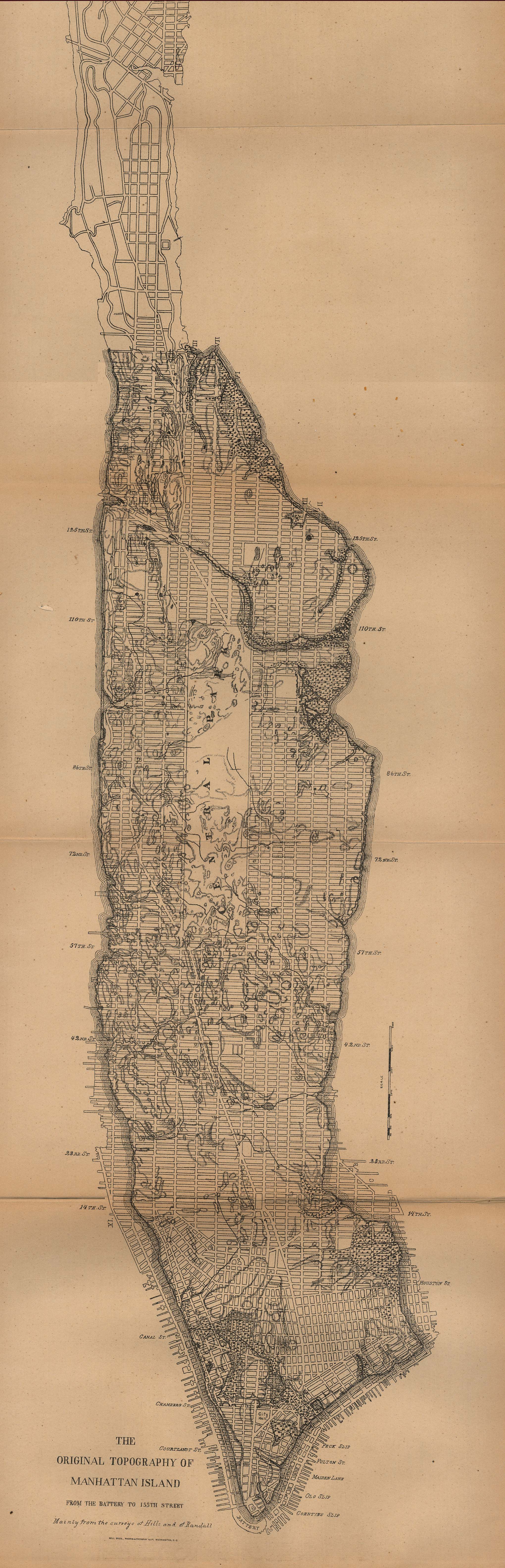
UPDATE: this map from 1880 is quite interesting. It shows the street grid at the time with the original topography overlaid.


No comments:
Post a Comment